1
Which Indian state possesses the longest coastline?
By Priya Sharma · Static GK Expert
A comprehensive collection of 20 high-quality objective questions covering the geographical features of India's coastline and its major/minor ports.
Which Indian state possesses the longest coastline?
Which port is known as the 'Child of Partition' because it was developed to compensate for the loss of Karachi port?
The Konkan Coast extends between which two locations?
Which of the following is India's first corporate port?
The 'Coromandel Coast' is located along which part of the Indian peninsula?
Which is the deepest landlocked and protected port in India?
Which port serves as the major iron ore export terminal for the Kudremukh iron mines?
What is the total length of India's coastline, including the Andaman & Nicobar and Lakshadweep islands?
Which major port is located at the mouth of the Zuari estuary?
Jawaharlal Nehru Port (Nhava Sheva) was built primarily to decongest which port?
Which port is popularly known as the 'Queen of the Arabian Sea'?
Which state has the second-longest coastline in India?
The 'Malabar Coast' runs from:
Which of these is an artificial, all-weather harbour?
Paradip port is located in which state?
Which of the following is a tidal port?
Which channel separates the Andaman Islands from the Nicobar Islands?
Tuticorin Port is located in which state?
Which port is famous for being a hub for the export of tea and coffee from the Western Ghats?
What is the name of the coastline of the Odisha state?
Which of the following ports is situated at the confluence of the Hooghly and Haldi rivers?
The coastline of Tamil Nadu is known by which of the following names?
Which major port is specifically designed to handle large quantities of iron ore exports from the Bailadila mines in Chhattisgarh?
Which of the following is India’s only major port situated on a riverine island?
The 'Kanara Coast' or 'Karnataka Coast' is situated between which two regions?
Which state has the shortest coastline in mainland India?
The 'Kathiawar' coast is a prominent geographical feature of which Indian state?
Which port is India's premier container port, handling over 50% of the country's total containerized cargo?
What is the primary characteristic of the Western Coastal Plain compared to the Eastern Coastal Plain?
Which port is known as the 'Gateway of India' for trade with the Middle East and Europe?
Which of the following ports is an 'all-weather' port located in the Andaman and Nicobar Islands?
The 'Vembanad Lake' is closely associated with which major port?
Which port is known for its specialized handling of crude oil imports via the Salaya-Mathura pipeline?
Which of the following coastlines is characterized by the presence of 'Lagoons' and 'Kayals'?
The 'Gulf of Kutch' and 'Gulf of Khambhat' are situated in which state?
Which port is recognized as an artificial harbour constructed to handle the heavy traffic of the Coromandel coast?
Which state's coastline is historically referred to as the 'Northern Circars'?
Which major port is situated closest to the equator?
The 'Diamond Harbour' is located in which state and on which river?
Which of the following is a 'Satellite Port' developed to decongest Chennai Port?
Which of the following ports is situated at the southern tip of India and is historically significant for pearl fishing?
The 'Northern Circars' coastline historically refers to the coastal region of which modern-day state?
Which of the following ports handles the bulk of the exports of iron ore from the Bailadila mines via the Kirandul-Kottavalasa railway line?
The 'Konkan' coast stretches from Daman in the north to which location in the south?
Which major Indian port is the first in India to be connected to a 'Dedicated Freight Corridor'?
The 'Lakshadweep' islands are composed of which type of geological structure?
Which Indian port is specifically known as a 'Satellite Port' for the Jawaharlal Nehru Port (JNPT)?
The coastline of Kerala is famously known for its 'Backwaters'. What are these locally called?
Which major port is situated on the island of 'Willingdon'?
The 'Palk Strait' lies between which two landmasses?
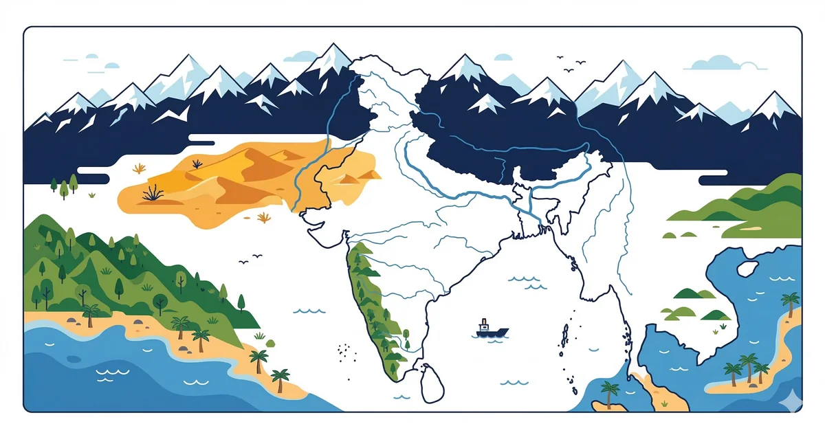
India boasts a vast coastline extending approximately 7,516.6 km. This includes the mainland coastline of 5,422.6 km and the coastlines of the islands (Andaman & Nicobar and Lakshadweep) spanning 2,094 km.
India's maritime trade is facilitated by 13 major ports and approximately 200+ non-major (minor) ports. Major ports are governed by the Major Port Authorities Act, 2021, and fall under the jurisdiction of the Union Government, while minor ports are managed by state maritime boards.
India has a coastline of 7,516.6 km (mainland + island territories), making it one of the longest coastlines in Asia. Indian coastline and ports MCQ questions cover the 13 major ports, coastal state borders, important straits, and maritime geography. This is a high-value topic in SSC CGL, UPSC Prelims, and RRB NTPC.
India's 13 major ports (under the Major Port Trusts Act, now Major Port Authorities Act 2021) are: Deendayal (Kandla), Mumbai, JNPT (Navi Mumbai), Marmugao (Goa), New Mangalore, Cochin, Chennai, Kamarajar (Ennore), V.O. Chidambaranar (Tuticorin), Visakhapatnam, Paradip, Kolkata, and Syama Prasad Mookerjee Port (Haldia). JNPT handles the highest container traffic; Deendayal (Kandla) handles the highest cargo tonnage.
9 states and 4 UTs have coastlines. West coast (Arabian Sea): Gujarat, Maharashtra, Goa, Karnataka, Kerala. East coast (Bay of Bengal): Odisha, West Bengal, Andhra Pradesh, Tamil Nadu. Tamil Nadu touches both coasts — the Kanniyakumari district is where the Arabian Sea, Bay of Bengal, and Indian Ocean meet.
Deendayal Port (formerly Kandla Port) in Gujarat handles the highest cargo tonnage. JNPT (Jawaharlal Nehru Port) handles the highest container traffic.
The Palk Strait separates Tamil Nadu (India) from northern Sri Lanka. It connects the Bay of Bengal with the Palk Bay.
About the Author
Indian History · Geography · Polity & Economy Specialist
With 8+ years of teaching static GK for competitive exams, Priya has helped thousands of students master the foundational subjects that appear year after year in UPSC, SSC, and Railway exams. She focuses on making history, geography, and polity approachable through well-structured MCQs and memorable explanations.