Indian Geography MCQ Questions
19 topic-wise quiz sets · practice with answers · UPSC SSC RRB
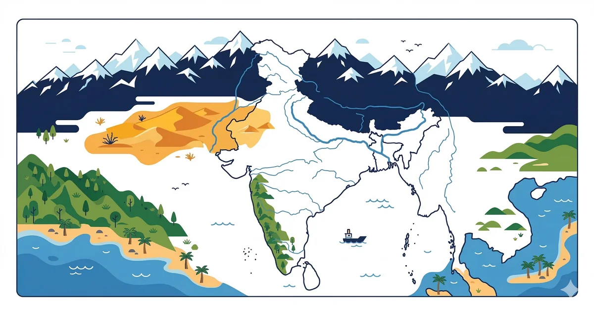
Rivers, mountains, passes, national parks, states, climate zones, and dams
Agricultural Regions
This quiz covers the classification, geographical distribution, and regional characteristics of Indian agriculture, including cropping patterns and agro-climatic zones.
Agricultural RegionsBiosphere Reserves
This quiz covers essential static knowledge regarding India's Biosphere Reserves, their locations, and their international recognition under the MAB program.
Biosphere ReservesClimate & Monsoon
A comprehensive collection of 20 multiple-choice questions covering the climatic characteristics, monsoon mechanisms, and seasonal patterns of India.
Climate & MonsoonCoastline & Ports
A comprehensive collection of 20 high-quality objective questions covering the geographical features of India's coastline and its major/minor ports.
Coastline & PortsDams & Reservoirs
A comprehensive collection of 20 high-quality MCQ questions covering major dams and reservoirs across India for competitive exams.
Dams & ReservoirsDeserts & Plains
A comprehensive collection of 20 high-quality MCQ questions covering the physiographic features, formation, and distribution of deserts and plains in the Indian subcontinent.
Deserts & PlainsIslands of India
A comprehensive collection of 20 high-quality MCQ questions covering the geographical, physical, and administrative aspects of the Indian island groups.
Islands of IndiaLakes & Wetlands
A comprehensive collection of 20 MCQs covering the geographical, ecological, and static features of Indian lakes and wetlands.
Lakes & WetlandsMinerals & Mining
A comprehensive collection of 20 high-quality MCQ questions covering the distribution, extraction, and geological significance of minerals in India.
Minerals & MiningMountain Passes
A comprehensive quiz covering significant mountain passes in India, their geographical locations, and their strategic importance for competitive exams.
Mountain PassesMountains & Peaks of India
20 MCQs on major mountains and peaks of India — Himalayas, Western Ghats, K2 and more for UPSC and SSC exams.
Mountains & PeaksMountains and Passes of India
20 MCQs on mountain ranges, peaks, and passes of India — Himalayas, Western Ghats, Deccan, and strategic passes for UPSC and SSC exams.
Mountains and PassesNational Parks & Wildlife Sanctuaries
A comprehensive collection of 20 high-quality MCQ questions covering the geography, location, and key features of National Parks and Wildlife Sanctuaries in India.
National Parks & Wildlife SanctuariesNeighbouring Countries
A comprehensive collection of 20 MCQs covering the geographical boundaries, borders, and relations between India and its neighbouring nations.
Neighbouring CountriesPhysical Divisions of India
A comprehensive collection of 20 high-quality objective questions covering the physiographic regions of India, including mountains, plains, plateaus, and coastal areas.
Physical Divisions of IndiaRivers of India
Rivers of India GK — Ganga, Yamuna, Brahmaputra, Godavari, Krishna, Cauvery, Narmada, river origins, tributaries, dams, and river-based disputes. Essential for UPSC Prelims, SSC CGL, RRB NTPC, and State PSC 2026.
Rivers of IndiaSoil Types
A comprehensive collection of 20 multiple-choice questions covering the characteristics, distribution, and classification of soils in India.
Soil TypesStates & Union Territories
A comprehensive collection of 20 high-quality objective questions focusing on the geographical, historical, and constitutional aspects of Indian States and Union Territories.
States & Union TerritoriesWorld Geography Basics
A comprehensive collection of 20 medium-difficulty MCQs covering fundamental concepts of physical and political world geography.
World Geography BasicsIndian Geography MCQ Questions — Rivers, Mountains, National Parks & More for UPSC, SSC CGL & RRB NTPC 2026
Geography is one of the most consistent scoring topics across Indian competitive exams. From the rivers of the Himalayan system to the biosphere reserves of peninsular India, Indian geography MCQ for UPSC SSC CGL RRB NTPC covers a vast but well-defined terrain. The subject rewards candidates who can visualise India's physical map — because a large number of questions test relative positions, drainage patterns, and regional characteristics that pure memorisation alone cannot handle.
This section contains quiz sets covering every major geography sub-topic from the exam syllabus — rivers and their tributaries, mountain passes, national parks and wildlife sanctuaries, biosphere reserves, states and union territories, dams, coastline and ports, lakes, and soil types. Use these to build a complete, exam-ready understanding of India's physical and human geography.
Rivers of India — The Most Tested Geography Topic
Rivers of India questions SSC CGL and UPSC papers feature year after year. The Himalayan rivers — Indus, Ganga, and Brahmaputra — are perennial (fed by glaciers and rain). The Peninsular rivers — Godavari, Krishna, Mahanadi, Narmada, Tapi — are mostly seasonal, except during monsoon.
Key facts that appear constantly: The Ganga originates from Gangotri Glacier and meets the Bay of Bengal at the Sundarbans delta. The Brahmaputra enters India through Arunachal Pradesh and is called Tsangpo in Tibet and Jamuna in Bangladesh. The Narmada and Tapi flow westward into the Arabian Sea through rift valleys (fault troughs) — a distinction that regularly trips up unprepared candidates who assume all peninsular rivers flow east. The Godavari is the longest peninsular river and is called the Dakshin Ganga (Ganga of the South).
Tributaries are a favourite sub-topic. The Yamuna, Ghaghra, Gandak, and Kosi are major left-bank tributaries of the Ganga. The Chambal, Betwa, Son, and Tons join from the right. The Kosi is called the "Sorrow of Bihar" due to its frequent floods caused by heavy sediment load.
Mountains, Passes & Physical Divisions
The Himalayas divide into three parallel ranges: the Greater Himalayas (Himadri), the Lesser Himalayas (Himachal), and the Outer Himalayas (Shivalik). K2 (Godwin-Austen) at 8,611 m is the second-highest peak in the world and the highest in India's administered territory. Kanchenjunga (8,586 m) in Sikkim is the third-highest in the world.
Mountain passes are a high-value topic in physical geography of India questions competitive exams. Nathu La and Jelep La (Sikkim) connect India with China. Zoji La (J&K/Ladakh) connects Srinagar with Leh. Shipki La (Himachal Pradesh) is on the India–China border and through it the Sutlej enters India. Bolan Pass in Pakistan and Khyber Pass connect the subcontinent to Afghanistan — historically significant and occasionally tested.
The Deccan Plateau, bounded by the Western Ghats and Eastern Ghats, is the largest plateau in India. The Western Ghats (Sahyadri) run parallel to the west coast and act as a barrier to the southwest monsoon, causing heavy rainfall on the windward side and a rain shadow region on the leeward (eastern) side — important for questions on climate and agriculture.
National Parks, Wildlife Sanctuaries & Biosphere Reserves
National parks wildlife sanctuaries MCQ questions are particularly common in UPSC and State Forest Service exams. Jim Corbett National Park (Uttarakhand) was the first national park established in India in 1936 (originally called Hailey National Park). It was also the first tiger reserve under Project Tiger (1973). Kaziranga National Park (Assam) is home to two-thirds of the world's one-horned rhinoceroses and is a UNESCO World Heritage Site.
Gir National Park (Gujarat) is the only natural habitat of the Asiatic lion. Sundarbans National Park (West Bengal) hosts the largest population of Bengal tigers and is a UNESCO World Heritage Site. Manas National Park (Assam) is both a UNESCO World Heritage Site and a Project Tiger reserve — a combination tested in multiple exams.
India has 18 Biosphere Reserves that are part of UNESCO's Man and Biosphere (MAB) Programme. Nilgiri was the first Biosphere Reserve in India (1986) and also the first to be included in the UNESCO World Network of Biosphere Reserves (2000). Sundarbans, Gulf of Mannar, Nanda Devi, Simlipal, and the Great Nicobar Biosphere Reserve are part of this international list.
States, Union Territories & Key Facts
Indian states and capitals MCQ questions test both the pairing of states with capitals and comparative facts. Rajasthan is the largest state by area; Uttar Pradesh is the most populous. Goa is the smallest state by area; Sikkim is the least populous. The newest states — Telangana (2014) and the reorganised Jammu & Kashmir (2019, divided into two Union Territories) — are regularly tested.
Among Union Territories, Delhi and Puducherry have their own legislatures. Ladakh (carved out of J&K in 2019) is the largest UT by area. Lakshadweep is the smallest UT. The total count: 28 states and 8 Union Territories as of 2020 — the number changed when Daman & Diu and Dadra & Nagar Haveli were merged into a single UT in January 2020.
Dams, Lakes & Coastline
Dam questions focus on which river a dam is built on and which states benefit. Tehri Dam (Uttarakhand) on the Bhagirathi river is the tallest dam in India. Hirakud Dam (Odisha) on the Mahanadi river is the longest dam in India. Bhakra Nangal Dam (Himachal Pradesh/Punjab) on the Sutlej was built with the help of the World Bank and is associated with Jawaharlal Nehru's famous "temples of modern India" quote.
India has a coastline of approximately 7,516 km, making it the 7th longest in the world. Gujarat has the longest state coastline, followed by Andhra Pradesh. The Lakshadweep Islands are coral islands in the Arabian Sea; the Andaman & Nicobar Islands are in the Bay of Bengal, with the southernmost point — Indira Point — being India's southernmost tip.
Exam Weightage for Geography
- UPSC Prelims: 8–12 questions; physical geography and environment dominate
- SSC CGL Tier 1: 3–5 questions; rivers, mountains, and national parks most common
- RRB NTPC CBT-1: 3–4 questions; focus on rivers, states, and national parks
- SSC CHSL: 2–4 questions; straightforward fact-based questions
- State PSC: 10–15 questions with heavier focus on the specific state's geography
How to Use These Quiz Sets
Each quiz covers a distinct geography sub-topic. Attempt them alongside a physical map of India — the habit of mentally locating rivers, passes, and national parks on a map accelerates retention far faster than reading alone. Focus especially on the "which river / which state / which border" pattern questions, as these form the bulk of geography MCQs in SSC CGL and RRB NTPC papers.
Frequently Asked Questions — Indian Geography MCQ
Which Indian geography topics are most important for UPSC Prelims?
How many geography MCQ questions appear in SSC CGL?
What are the best resources for physical geography of India questions and answers?
How many questions on rivers, mountains, and national parks appear in competitive exams?
Is Indian geography enough for RRB NTPC, or should I study world geography too?
About the Author
Indian History · Geography · Polity & Economy Specialist
With 8+ years of teaching static GK for competitive exams, Priya has helped thousands of students master the foundational subjects that appear year after year in UPSC, SSC, and Railway exams. She focuses on making history, geography, and polity approachable through well-structured MCQs and memorable explanations.