1
Which is the longest river in India?
By Priya Sharma · Static GK Expert
Rivers of India GK — Ganga, Yamuna, Brahmaputra, Godavari, Krishna, Cauvery, Narmada, river origins, tributaries, dams, and river-based disputes. Essential for UPSC Prelims, SSC CGL, RRB NTPC, and State PSC 2026.
Which is the longest river in India?
The river Brahmaputra originates from which glacier?
Which river is known as the 'Dakshin Ganga' (Ganga of the South)?
The Indus river originates from which lake?
Which river forms the Bhakra Nangal dam?
The river Yamuna meets the Ganga at which city?
Which of the following rivers flows westward and drains into the Arabian Sea?
The Chilika Lake, India's largest coastal lagoon, is located near which river's delta?
Which river is called the 'Life Line of Rajasthan'?
The Damodar river is a tributary of which major river?
Which river separates the Vindhya and Satpura mountain ranges?
The Cauvery river originates from which state?
Which river is associated with the Tehri Dam, the highest dam in India?
The 'Ganga Action Plan' was launched to clean the Ganga river in which year?
Which river passes through the Siliguri Corridor (Chicken's Neck)?
The river Son is a major tributary of which river?
Which river is known as the 'Sorrow of Bihar'?
Panchganga, Dudhganga, Tulabhandra are tributaries of which river?
The National Waterway 1 (NW-1) runs along which river?
Which river drains the largest basin area in India?
Which of the following rivers is known as the 'Dakshin Ganga'?
The 'Jog Falls' are situated on which of the following rivers?
Which river forms the 'Dhuandhar Falls' near Jabalpur?
Which among the following is a right-bank tributary of the River Ganga?
The 'Indus Waters Treaty' was signed between India and Pakistan in which year?
Which river flows through a rift valley in India?
Which of the following rivers does not form a delta?
The 'Teesta' river originates in which state?
Which is the longest river flowing entirely within India?
The 'Hira-Kund' dam is constructed on which river?
Which of the following is the source of the River Krishna?
Which river is often referred to as the 'Sorrow of Bihar'?
The 'Luni' river terminates in which of the following?
Which river marks the boundary between India and Nepal?
The 'Brahmaputra' enters India through which pass?
Which among the following is a tributary of the Cauvery?
Which river system has the highest density of drainage in India?
The 'Chambal' river is a primary tributary of which river?
Which river is famous for the formation of the 'Majuli' river island?
What is the confluence of Alaknanda and Bhagirathi known as?
Which of the following glaciers is the primary source of the Alaknanda river?
The 'Shivanasamudra Falls' are located on the course of which river?
Which river is colloquially known as 'Vridha Ganga' due to its age and length?
Which of the following rivers flows through the Purna, Wardha, and Wainganga tributaries?
What is the name of the river on which the 'Sardar Sarovar Dam' is built?
Which river is known as the 'Sorrow of Bengal' due to its devastating floods?
The 'Rann of Kutch' acts as the drainage basin for which of the following rivers?
Which of the following is the largest tributary of the Indus river system in terms of discharge?
The 'Tungabhadra' river is a major tributary of which of the following river systems?
Which river originates from the 'Amarkantak' plateau alongside the Narmada?
The 'Indravati' river is a prominent tributary of which river basin?
Which of the following rivers forms the 'Dudhsagar Falls' on the border of Goa and Karnataka?
The 'Barak' river, which flows into Bangladesh, originates in which state?
Which river system is noted for forming a 'bird's foot delta'?
The 'Ghaggar' river is considered to be the remnants of which ancient river?
Which river provides the main water supply for the 'Indira Gandhi Canal'?
Which of the following is a peninsular river that flows through a rift valley?
The 'Shyok' river is a tributary of which of the following rivers?
Which river marks the approximate boundary between the Deccan plateau and the Indo-Gangetic plains?
The 'Pamba' river is a primary river of which Indian state?
The 'Beas' river, which is a major tributary of the Indus system, meets the Sutlej river at which location?
Which of the following peninsular rivers forms a 'fanning out' estuary rather than a delta?
The 'Panjnad' is a collective name for five rivers of Punjab. Which of these is NOT one of the five?
Which river acts as the western boundary of the Chota Nagpur Plateau and separates it from the Hazaribagh plateau?
Which among the following is the longest left-bank tributary of the Ganga?
The 'Bhavani', 'Kabini', and 'Amaravati' are notable tributaries of which river?
Which river flows through the 'Marble Rocks' gorge near Bhedaghat?
The confluence of the 'Devprayag' is formed by the union of which two rivers?
Which of the following rivers is known as the 'Dakshina Pinakini'?
The 'Musiri' and 'Musi' rivers are associated with the drainage of which major river basin?
The river systems of India are broadly classified based on their origin and water flow patterns. These systems form the backbone of the Indian agrarian economy and hold significant weight in UPSC, SSC, and State PSC geography papers.
Originating from the snow-fed mountains, these are perennial rivers.
These are rain-fed (non-perennial) rivers characterized by fixed courses and well-adjusted valleys.
To excel in competitive exams, focus on these frequently asked technical parameters:
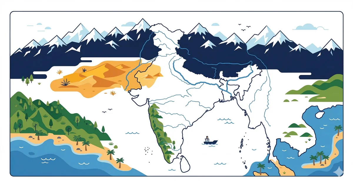
Rivers of India is one of the most frequently tested topics in Indian geography MCQ for UPSC SSC CGL RRB NTPC. The Himalayan river system — Indus, Ganga, and Brahmaputra — and the peninsular river system — Godavari, Krishna, Cauvery, Mahanadi, Narmada, and Tapti — together form the backbone of India's physical geography. Questions on rivers appear in virtually every competitive exam and typically account for 2–4 marks in a single paper.
The Ganga originates at Gangotri Glacier (Uttarakhand) and flows 2,525 km before entering the Bay of Bengal. Its major right-bank tributaries include Yamuna, Son, and Gandak; left-bank tributaries include Gomti, Ghaghra (Saryu), and Kosi. The Brahmaputra — known as Tsangpo in Tibet and Jamuna in Bangladesh — is unique in that it flows east in Tibet, turns sharply at the Namcha Barwa massif, and enters India from the east. It has the highest silt load among all Indian rivers.
Most peninsular rivers flow east into the Bay of Bengal and form deltas. Godavari (the 'Ganga of the South', originates at Trimbakeshwar, Maharashtra), Krishna (originates at Mahabaleshwar), Cauvery (Talakaveri, Kodagu), and Mahanadi (Raipur plateau) are the major east-flowing rivers. Narmada and Tapti are exceptions — they flow west into the Arabian Sea through rift valleys (graben structures), forming estuaries instead of deltas.
West-flowing rivers generally have steeper gradients and shorter courses. The Periyar, Sharavati (source of Jog Falls), and Mandovi-Zuari are important west-flowing rivers in Kerala, Karnataka, and Goa respectively. SSC CGL frequently asks: "Which river flows through a rift valley?" — the answer is Narmada (and Tapti).
Certain river-related facts appear across UPSC Prelims, SSC CGL, RRB NTPC, and State PSC papers year after year. The Indus is the longest river associated with India (total length 3,180 km) but most of it flows through Pakistan. The Ganga at 2,525 km is the longest river entirely within India. The Nile (6,650 km) is the world's longest river — this cross-checks "Indian geography questions for competitive exams 2026" that mix world geography.
The Sundarbans delta — shared between India and Bangladesh — is the world's largest mangrove delta and is formed by the Ganga-Brahmaputra system. It is a UNESCO World Heritage Site and home to the Bengal tiger. This fact connects rivers MCQ with national parks MCQ in exams.
The Kosi river, a left-bank tributary of the Ganga, is called the 'Sorrow of Bihar' because of its frequent course changes and devastating floods. It originates in Nepal and joins the Ganga near Kursela.
The Narmada and Tapti (Tapi) flow through rift valleys (grabens) in the Vindhya-Satpura region and empty into the Gulf of Khambhat (Arabian Sea), forming estuaries not deltas.
The Ganga originates from the Gangotri Glacier in Uttarkashi district, Uttarakhand. The stream emerging from the glacier is called Bhagirathi, which meets Alaknanda at Devprayag to form the Ganga.
About the Author
Indian History · Geography · Polity & Economy Specialist
With 8+ years of teaching static GK for competitive exams, Priya has helped thousands of students master the foundational subjects that appear year after year in UPSC, SSC, and Railway exams. She focuses on making history, geography, and polity approachable through well-structured MCQs and memorable explanations.